
Every once in a while, I find myself undertaking improbable tasks. It seems that, no matter how hard I work, nothing comes together until the final hours. And let me be clear: last minute success is not something to strive for. But if it the best one can do, it is good enough.
I can't sleep. Four hours ago I laid down in bed and yet I am able to remember every minute. Looking at the cheap alarm clock overturned on its side and thrown in a corner I remark that it is surprisingly early. 1:39 A.M. Two hours until I need to wake up. If only I were asleep.
It's the night before I begin a three day solo drive across the United States, from Troy, NY to Vancouver, Washington. I am driving a 15 year old Honda Civic coupe, standard, with homemade cruise control. As I listen to the rain pounding outside, I wonder if the plastic trash bag I draped over the back is adequately preventing water from leaking into the trunk.
1:42 A.M. Time to get up.
A cold rain falls as I remove the trash bag, load the last of the packs, setup my phone, and warm up the car. Goodbye Troy.
 |
| A full day's drive. |
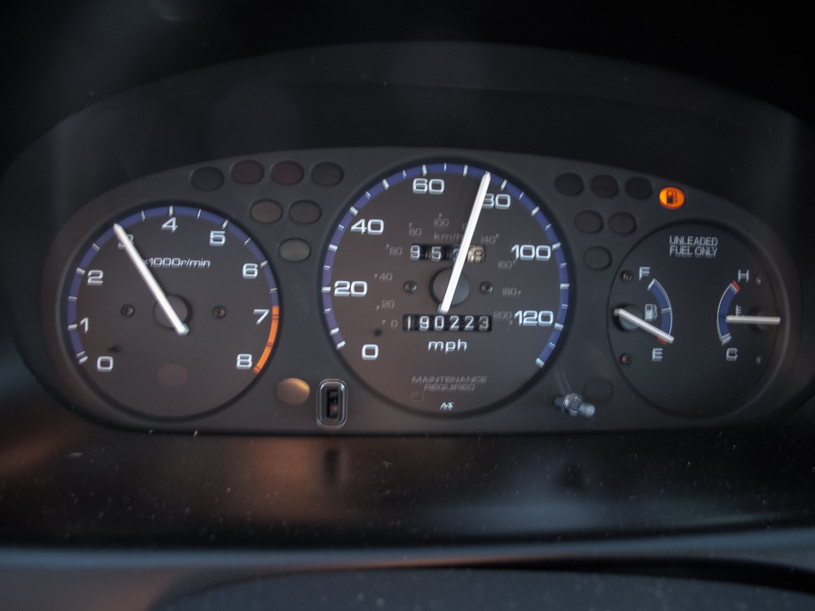
Pulling out of the first toll booth on I-90, I advance the hand throttle. I push my feet past the pedals to the firewall and for the first time, I am able to relax. The day before leaving a friend and I had just finished installing the next best thing to cruise control: a hand throttle. The design is analogous to a boat throttle. Push the control arm forward for more power; lower it to reduce power. The way the cable end is designed, the car can still be driven by pedal without any change in pedal feel. Push in the clutch to disengage. As three, four, and five in the morning come and go, I realize there is no way I would be able to drive for nearly 18 hours without the throttle.
I am running out of fuel annoyingly fast. With the bike on top and driving 80, I only get 30 mpg if I am lucky. The first stop comes at the Clarence service area on I-90 just east of Buffalo, NY. Nine gallons and 40 push-ups later I am driving again.
 |
| Snow, sleet, freezing rain. It's all the same. Erie, PA. |
The cold sunrise slowly lights the sky in the rear-view mirror. Pennsylvania comes and goes. The traffic transitions to mostly truck traffic. Time moves slowly, but I begin to transition into the right mentality. There is something innately satisfying about being continuously moving. Life is simplified. Follow the rhythmic pulse of the white lines, watch the scenery, check fuel, eat. That focus. It's like climbing.
 |
| Heavy truck traffic cuts through Ohio farmland. Austinburg, OH. |
 |
| An old barn amidst the corn. Austinburg, OH |
I continue to roll westward, stopping for gas again in Ohio and Indiana. The transition from the mixed forests of upstate New York to the woods spotting the fields in Ohio is gradual but definite. I revisit the spotty memories of the last few hours and the changes play back in stop motion.
 |
| Remnants of the last snowfall. Howe, IN. |
 |
| The grid. Somewhere in Indiana. |
The police presence is strong in Ohio, Indian and Illinois. I see an Illinois Sheriff pull a u-turn on the road ahead so I slow from 80. He drives along in front for a half mile and then pulls over until I pass. Nearly certain I will be stopped for speeding, I drive along slowly behind a truck. The officer pulls up next to my left rear quarter panel and watches me for a while. He dives in behind, flicks his lights, and soon I am stopped beside the road. Sitting in my car trying to discretely hide the homemade throttle, I struggle to pull my wallet out of my jeans.
"What's that by your arm there?" he demands.
"Cruise control...for my car."
"Did you build it yourself?"
"Yeah..."
He's going to tell me I have to take it off or that my car isn't legal. He pauses.
"License, registration and insurance please."
Relieved, I open the glove compartment and give him the papers. He looks at them a little and says,
"I'd like you to step out of the car and come sit in the passenger seat of my car. I've got a dog. She might bark a little."
Seating myself in his car I am reminded why police use German Shepherds. The whole car shakes as the dog slams back and forth in its metal cage, barking a few inches behind my head. The officer sits, an amused smile barely hidden beneath a man doing his job.
"Where are you from, what are you doing driving through Illinois?"
The questions come quickly. I'll get a warning for following too closely behind the truck. He just wanted an excuse to pull me over. I'm just glad to be stepping out of the car and away from the snarling hound. I've grown up around large dogs and like dogs, but I would not want to deal with that animal.
 |
| Illinois countryside. |
The sun begins to set. More Redbull. I-80 begins to drop and soon I am crossing the Mississippi. It's truly a huge river, even in Moline. The short climb up the west slopes completes the transition. I am now west of the Mississippi.
 |
| The Mississippi River. Davenport, IA. |
 |
| Prairie sunset. East of Des Moines, IA. |
The sun sets slowly, illuminating the sky blue, pink, and orange. The sky seems to fill three quarters of what I can see. It's a big country. I drive until I am tired again and I crash at Des Moines Comfort Inn. Turning on the TV, I see there's been a shooting. The announcer won't say where it happened but KGW-TV shows in one of the corners. It's Portland, OR.
It's strange being reconnected with the real world. 9:30 P.M. I am asleep.
The sickeningly sweet alarm awakens me at 5:30. A quick breakfast and I am driving again. This time I get to watch the sunrise through the mirrors. The weather looks good.
 |
| Prairie sunrise in the mirrors. West of Des Moines, IA. |
Omaha comes and goes as I drive out onto the flat cornfields of central Nebraska. Midway through a thirty mile, dead level straight my mother calls. I tell her it's flatter than North Dakota and she asks if that's possible. It is. Glancing at my phone I am slightly surprised to see "840 miles to the next turn." I'll be making that turn sometime in the dark later tonight.
 |
| Corn fields near Aurora, NE. |
 |
| Just past Lincoln, NE. 840 miles to the next turn. |
 |
| Straight. I-80 near Aurora, NE. |
After driving 80-90 mph on such straight roads 70 mph seems slow. The car picks up a vibration during one of the long runs and I consider pulling over, but the fuel is running low so I push on until the gas light comes on. There's miles between the exits here so the next one I see I take. What looks like an abandoned gas station has running pumps and I am relieved. Every five minutes or so a car passes so I don't bother to move the car from the pump when I look for the issue.
All that driving has let me think. The car's been to a couple mechanics, none of whom have been able to find a vibration at speed. The Midas mechanic's voice comes back to me, "We took it all the way up to 75 on the dyno and got nothing." It occurs to me that perhaps the other mechanic didn't drive my car either. And then one of those times when everything seems to come together.
Two years ago Boeing Commercial Airlines was testing the new 747 for flutter. They found that the nose gear doors did, in fact, vibrate at approach speeds. There's got to be something under the car that shakes with speed.
Here's what I found:
 | |
| Flutter induced vibration three miles from Overton, NE. |
I jack the car up, remove the right front tire and now I am able to see the damage. Some fasteners have come loose from the spray shields around the engine bay. Rummaging through the glove compartment I am disappointed to find only some butterfly clips for holding papers together and duct tape. I take the silver wire off one side. It'll have to do. Forcing the ends through the old bolt hole, I test it's holding power. It seems fine so I tape up the plastic.
 |
| Solution. |
A noise startles me and my head whips around. I though I was alone. Two men are working on the abandoned gas station, reinstalling fluorescent light covers and cleaning the side walk. Their Indian accents seem in stark contrast to the thirty degree temperature and the blowing wind. America must still be a land of opportunity. My car fixed, I pull out to the highway. The deserted corn fields and desolate surroundings remind me of that old Albert Hitchcock movie North by Northwest. Only the crop duster is missing.
 |
| North by Northwest. Overton, NE. |
 |
| Central Nebraska |
 |
| High prairie in western Nebraska. Two hours from Cheyenne, WY. |
The road begins to climb as I near the Colorado border. The vast ranches stretch away from the road in all directions. Before fences this must have been very wild indeed.
 |
| Eight hundred pound round bales lie scattered in a field in western Nebraska. |
The road climbs steeply for the first time since New York and I find myself in Pine Bluffs. Considering the time I've been driving it's almost surprising to be in Wyoming already. The wind scoured forest sits on low bluffs; the first real forest I have seen in a while.
 |
| Common routes. Pine Bluffs, WY. |
 |
| Running on empty. Between Pine Bluffs and Cheyenne, WY. |
The headwind has picked up. When I fuel up just before Cheyenne, I record 22.8mpg. The car normally gets 40 mpg. Having driven for 10 hours already, I am looking forward to the sunset, but not to slow driving. A long, but low grade out of Cheyenne surprises me as I am forced to downshift from 5th to 4th gear on the freeway. 65mph is desperately slow, but even flat out down hill the car only goes 70mph. Sometimes the windows sound like they are going to fall off as the wind scrabbles and claws at the car.
 |
| Turtle Rock and others. Wallis Recreation Area, WY. |
The views begin to be rewarding as the sun sinks lower on the horizon. I am still climbing, but I'm not paying attention to the road anymore. All this rock around me makes me want to stop and boulder, or at least scramble.
 |
| Wallis Recreation Area, WY. |
I come across the sign below. I can't believe it. At home I would be at the top of the lifts on the highest ski resort around, Timberline, yet here in Wyoming it's a pass on a freeway.
 |
| The pass before the long hill into Laramie, WY. |
As I finally begin to make up time driving down the 5% grade into Laramie, I realize I'll never make it to Brigham City, UT if I don't speed up. The only way that will happen is by tailgating trucks.
"WIND GUSTS 50+ MPH," the sign reads, so I drive up behind a truck. The car is flat out and I'm barely able to catch it. My speed resumes to 80 mph, 12 feet behind a semi trailer.
 |
| Windy Wyoming |
 |
| Descending into Laramie, WY. |
One of the best sunsets I have ever seen follows. The cold windswept land is perfectly framed by a frigid winter sun. I promise myself I will return.
 |
| Wyoming sunset. Walcott Jct, WY. |
 |
 |
| Tailgating truckers for mileage. |
Nightfall. Trucks whip past as I stay glued to a produce trailer. This trucker knows how to drive fast. I make it 380 miles on this tank, good for 37mpg. I nearly run out of gas somewhere after Green River, but I find a station just in time, the only thing open in the little town. The long S-turns down the canyon into Ogden are a welcome awakening from the straight roads of the plains. Finally over the continental divide, I find the cheapest dive I can ($51) and retire for the night.
 |
| Snow covered hills from the Blue Spring Hills, far north Utah. |
Waking the next morning in the dark, I am thankful for the time change. Three more hours of sleep over the trip makes all the difference. Today will be an easy day, only 11 hours. The clarity of the air this morning and the high snow reminds me of British Columbia. If only the windows were clearer, I would be able to get some better shots.
 |
| Rear view mirror. I-80 on the Utah, Idaho border. |
I suppose it's always a little frustrating. A camera's interpretation never quite equals one's memories of that special place. With all the post processing software available, it should be possible to bring that crisp visual depth to life, but somehow it escapes me. I should be happy that photos don't do the "wild west" justice; driving then becomes a privilege.
The trip morphs into more than just getting home. Driving across this country would make a patriot out of anyone. Corny, but true. There is simply so much variation in terrain, lifestyle, and people that the country would suffer greatly without its parts. Politics are tedious, to be sure, but we must feel compelled to protect a land like this. Few are as fortunate.
 |
| Magic Valley, ID. |
The cruise control is sticking more than ever now. I wish I had made the handle stronger so I had better control. Boise will pass by soon and the roads will become familiar. Six hours of driving lies ahead, but I already feel like I am home.
 |
| Big Bend, Snake River, OR. |
The long climb around Hell's Canyon on the Snake River comes as a welcome respite from the straight roads of the deserts. The freeway winds a sinuous trail through the sage covered hills, each direction parting at times to dodge small outcroppings and canyons. Illuminated by the clearest of blue skies, the land glows with patchy snow. It is cold.
 |
| Elkhorn Mountains near Baker City, OR. |
 |
| The Wallowa Mountains hanging in the distance above the ice fog. Baker City, OR |
I turn off the car, pop the hood, open the gas lid and step out into the brisk air.
"How can I help you?"
The question startles me, and then I remember it's Oregon. I'm not allowed to pump my own gas, but I can check the fluids. The faded green of the coolant is barely visible through the degraded white plastic reservoir. I spin the oil cap off the valve cover, and consider the tingling pain in my finger tips. It's strangely satisfying, like the bite of cold rock pulling at your skin in a good fist jam.
People always discuss climbing being a metaphor for life; that the pain and struggle, the triumphs are models for "real life." I am not so sure anymore, or perhaps, I just don't know. What compels one to place so much effort into a wholly pointless pursuit? Dopamine surely plays its part, but if this were all would climbing be the same? Would a genuinely pain free climb be worth anything? And what about a struggle free life? In my constantly evolving understanding of what I love to do, I can only be sure that the struggles give context to the successes.
 |
| The first of three warnings. |
My thoughts are interrupted by 50 mph turns and a steep grade. Snow covers the road here in the shade and my focus is once again the road. The car climbs best in 5th at 80mph, so I dive for the apex of every corner, slowly drifting outwards again to set up for the next corner. The motions of driving fast barely contain my excitement for I know that once I crest Deadman Pass, it is downhill all the way to home.
 |
| Weight variable speeds, Deadman Pass, OR. |
 |
| The Columbia River Basin from the Pendleton overlook. OR. |
And so the descent begins. I have seen this view a handful of times, but never has it been this clear. Low clouds line the Columbia River Basin; more fog ahead. Pendleton passes and soon i am descending gradually into the Columbia Gorge, past the weapons depots of Umatilla and Arlington. Nearly the entirety of the the U.S. chemical weapons are stored somewhere off in the fog, sequestered underground in earthen bunkers. Further north, in Washington, Hanford Nuclear Facility continues to struggle with its waste. It is poignant, perhaps, that with all the brilliant minds in the country we cannot fully correct mistakes made a half century ago.
 |
| Back in the Columbia River Gorge, The Dalles, OR. |
For all the time I have driven, all the landscapes I have seen, I am unprepared for the Columbia River Gorge. The setting sun, physical relief of the snow capped hills; even the cloud formations are exquisite. The half hour drive from Hood River to Cascade Locks becomes a few minutes and I take Exit 44 for the Bridge of the Gods. Native legend tells a story of two fighting brothers, whose father gives land on each side of the river. So that his families may be joined together once again, he creates a land bridge, the Bridge of the Gods. The myth is unremarkable until it is put in the context of modern geological science. Geologists have found that millennia ago, a large landslide blocked the entire Columbia River (~7,000 m^3/sec) for several days. The river eventually wore through, but the story lives on in Native tradition.
Today's Bridge of the Gods is a slightly less impressive white, steel cantilever structure with a metal grate deck. It was built in 1926 and feels that way when driven over. Eager to take in the views, I creep along at the 15 mph speed limit, feeling the car shake with the metal grate. As a child my father would drive to the middle of the bridge in his Jeep Grand Cherokee, stop, open the doors, and look down at the river. Looking through the grate, a once solid bridge becomes clear...all the way to the river.
 |
| Sunset over the Bonneville Dam, Washington. |
The final stretch. Highway 14 is an interesting road to drive. Its rolling twists and turns demand attention, but not so much to prevent one from enjoying the views. I stop the car at Cape Horn, the scenery is just too good to pass up. The depth of the Gorge is displayed unusually well. I am lucky, I tell myself, to grow up here.
 |
| Cape Horn and the Columbia River Gorge, WA. |
America is vast, yet I have managed to drive across it. I don't have an overwhelming sense of accomplishment or even pride. I am grateful to live here, honored to be able to do what many wish they could do, if only they were given the time, if they had the courage to take the time. There is a societal belief that people who do what they want even if it means a life of poverty are taking the easy way out. Freedom is much more frightening.
Work, at some level, is available to those who want it. Work is security and routine. If one works to meet the minimum requirements a life of work is easy to pursue. It takes immense courage to let this guarantee go. Those who step away from the driven nature of society should be respected.
I know I will never be able to turn my back on the privileges of modern American life. I simply do not have the courage, but I still have the desire. Ambivalence is challenging, but it is the source of most of my motivation. For the three days I have driven, the present focus has been there. The drive is a brief lapse into freedom.
I pull into the driveway and suddenly it is over.
4:47 P.M.
That night, lying barely awake I know it is good enough. At last I can sleep.
 |


