Saturday, March 31, 2012

3.31.2012 Shanty Cliff

This morning I left Troy at 6:30am with Charles, Cam, and Joe with the plan of climbing at the cliffs near Long Pond.  As usual, those plans ended up changing.  After 2 hours of driving, we came across a metal gate crossing the road that leads to the trailhead for the approach.  Access to the road would cut off 6 miles from the hike each way and we were not willing to spend the time to hike 20 miles and then barely have any time left to climb.  This didn't seem like a very enjoyable day, so we looked in the Adirondack Rock guidebook for somewhere else in the area.  Shanty Cliff was chosen as our destination, and it ended up being a good choice.


The guidebook said that the approach was only 15 minutes, which is the shortest one we have had in a long time.  However, there was one stream crossing listed, noted to be 1 to 2 feet deep in the summer.  The water was pretty cold, so Charles, Cam, and I decided to walk right through in our boots and gaiters, while Joe took off his shoes and braved the cold.


About 20 minutes later we arrive at the base of the cliffs and sorted out all of the gear for the day.  We spotted a nice looking hand crack and made that the first climb of the day.  Cam lead and I followed while Charles and Joe went up a 3rd class scramble to take some photos and check out the view.  The next series of photos are from this route.


From the top of the cliff, the view was excellent.  It was still snowing a little bit, and was cold all night, so the white covering could be seen on all the distant mountains.  Later in the day it warmed up and all the snow melted, but it was warm enough all day to only wear a fleece when climbing.  Cam ended up trying to pull off a Sharma and took his shirt off in the middle of one route.


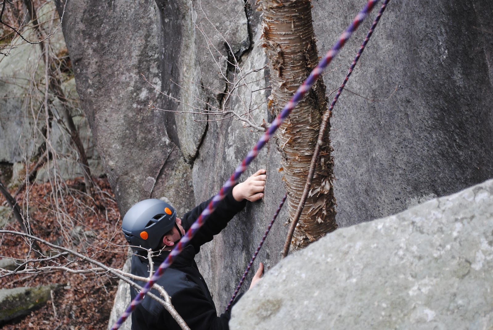
There were no other parties climbing or hiking when we were there, but it became apparent that this area was very developed when we came across bolted routes and anchors at the top of each climb.  Here I a attempting to lead a 5.8 sport route.


The next route was a 5.10a, which Cam took the lead on.  This was a mixed sport and trad route, so the best of both worlds.  Cam and I are seen climbing this route below.


Contemplating the next route.  Joe wanted to try one of the 5.7s on a nearby wall, so Cam lead it to set up a TR.  At the same time, Charles belayed me on a route that our second rope was already set up for.


I would call this next climb the best one of the day.  There weren't many spots for natural protection on this route, so the nice bolt ladder came in handy.  The climbing was pretty technical, at 5.11c, and the roof was intimidating from the ground.  Cam figured that if he took off his shirt like Chris Sharma, he would be able to climb at least a grade higher, but this wasn't the case.  We were both able to climb up to the first bolt on the roof, but Cam aided the second bolt before pulling over the roof.


I believe that this next route was a 5.8 that started off with a diagonal handcrack and lead to a nice layback off of a flake.  


After lunch we did one more route.  I lead, Cam pulled protection, and then Joe climbed it.  This one was a 5.7, but still a fun climb.  We had to be back in Troy early due to a time conflict, so this was one of the first trips I've been on in a while where headlamps were not required for the hike out.  All things considered, it was still a great day.  The weather turned out to be nice, the rock was dryish, and the views were great.  Instead of hiking back to the car the same way we came up, we went down a different way that followed a long creek that flows in to the river that we had to cross.  Even with this detour, it only took around 30 minutes to get back to the car.  The water at this crossing was faster moving and deeper that it was at the first spot, but it wasn't like wet boots would really matter for the short hike back to the car.  


Monday, March 12, 2012

3.10.2012 Pinnacle Gully

This past weekend was the start to spring break, so we had plenty of time to make a road trip to New Hampshire to heck out Mt. Washington.  Cam and I left Troy, NY at around 2:15pm with the goal of making it to the Pinkham Notch Visitor Center in under 5 hours.


We made pretty good time throughout the drive, no traffic at all.  There was daylight for a good amount of the drive through New York, Vermont, and most of New Hampshire.


There is limited camping permitted on Mt. Washington, but one of the popular spots to stay is at the Harvard  Cabin.  We had to sign in at the Pinkham Visitor Center to "reserve" a spot for that night, but ended up being the only ones camping outside.  It costs $5/person/night more to stay inside the cabin, which is heated and has a kitchen.  The caretaker of the cabin showed us around a few potential camping spots and we picked the one right down this path.


The ground was fairly flat, but we still had to shovel off the loose snow and chop a bit of snow and ice off of the sides of the site to fit the tent.  This was an optimal site because it was merely twenty meters away from the cabin, piss area, and hole in the ice to fill up water bottles.  After setting up the tent, organizing our gear, and putting on a couple extra layers of warm clothes it was time to sleep.  We ate a very large amount of lemon chicken in the car so there was no need to cook a dinner before bed.  On the menu for the next day and a half was 2 bags of Huevos Rancheros, 2 bags of Denver Omelete, 1 bag of Chicken a la King, 1 bag of Grilled Chicken and Mashed Potatoes, 2 packs of Ramen noodles, and 9 PB&J sandwiches.


At 6am the alarm on my watch woke the both of us up and we started to get ready right away.  It took about an hour to load our packs with all the gear we would need to climb, 2 sandwiches, and water.  On the hike out of the cabin area we spotted two forest rangers on snowmobiles who gave us the beta on weather and avalanche conditions.  The avalanche warning level throughout the entire area was moderate, so we weren't too worried.  Just to be safe we still had transceivers, probes, and shovels.  Below is the view from the trail leading to the floor beneath all of the gullies.


From this point the approach was a little more strenuous then I had imagined.  For some reason I thought we would have ended up right at the base of the gully, but it was still a good amount of vertical feet away from us.  The sun was just starting to burn off the fog so every time I looked back it was a better view than the last time.


Fresh footsteps were an indicator that a party had beat us to the gully, but they were also nice to follow instead of breaking trail.  The fog was still heavy enough to conceal the route ahead.


Just a few minutes later I looked back again to see if the fog was gone.  There is a huge difference between the picture below and the one that I mentioned above.


About one and a half hours later we were at the bottom of Pinnacle Gully.  We could still see the last climber of the party above on the first pitch, so to avoid getting hit by fallen ice and snow we racked up to the side of the gully.  By the time we finished getting our harnesses on, gear out, and crampons on it was time to start climbing.


Cam and I, respectively, are in the two photos below doing the last bit of soloing before getting to the first belay.  Pinnacle Gully is supposed to be a 3 pitch climb, but we were able to finish it in 2 pitches with the help of a 70 meter rope and fully stretched pitches.


All set up at the belay, climb when ready.


From the start, Cam works his way up the first pitch.


Once Cam built the second belay I put the camera back in my pack to climb up and remove the protection on the way.  He took the camera up the second pitch to get some shots of my coming up, seen below.


Wildcat Mountain seen in the distance from the top of Pinnacle Gully.  We could barely see the skiers, more like little black specs, moving down the trails.  The weather was perfect, very low wind, comfortable temps, and it seemed like a great opportunity to push for the summit.


As expected, the wind picked up as we gained altitude.  We later found out that the temperature at the summit was 9F and the winds were between 10 and 15 mph.  Compared to the day before and the following day these conditions were the best.


There were about 6 other people at the summit when we reached it, and one guy was willing to take a photo of Cam and I together.  After enjoying a quick PB&J and sip of water I packed up my camera for the hike down.  Instead of following the normal route that most people take, we decided to make our own direct route.  This route took us down to the top of Central Gully.  


 From there we down climbed until reaching the bottom, and them walked down to the trail that we were on earlier that day.


The trees opened up a bit on the trail back to Harvard Cabin to reveal a good view of Pinnacle Gully.


It was very nice to arrive back at the tent site and eat lots of warm food.  We were all cleaned up by the time it was 7pm and got all set up for a long nights sleep.


The next morning we woke up, packed up, and walked back down the Tuckerman Ravine trail that led us back to the car.  All of the avalanche warnings dropped to low for the day, and the weather was nice, which is probably why we passed at least 100 people hiking up on our way out.  Most people had splitboards or skis, but there were still a select few just hiking or with tools for ice climbing.  When we first arrived here, there were only a few cars parked in the lot.  At this time the lot was totally full, and there were cars lining the road outside of the lot for at least half a mile.