Rain was in the forecast from 2am Saturday morning until the end of Sunday, so it didn't seem like ideal weather for an overnight climbing trip starting Friday night. Cam and I decided to give it a go anyways, planning to aid climb if the weather was too bad. Armed with all of our normal gear, a 60m static rope, 2 jumars, and a tent, we left Troy at 4:20pm and drove toward exit 25 on 87N. We decided to drive past where we had to park and look for a general store to get some extra food to eat before we headed out to find a tent site. This was a good move, we got a box of couscous and other snacks, including a bag of Doritos that we left in car for the ride back. There are no trails or designated camping areas around the cliffs, so we had to navigate through the forest to end up at our final destination for the night.
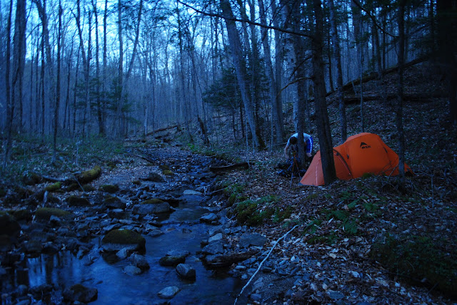
I think we found the only section of flat and clean ground in the area, and it was just four feet away from a plentiful water source. After setting up the tent and drinking some water from the stream, we decided to hike towards the cliffs to get a better view of what we would be climbing the next day.
The viewpoint was only 20 minutes away from the tent. Now it was getting dark, so we turned on headlamps and walked back to the tent to make dinner, organize gear, and get some sleep. It was around 9pm when we laid down on the sleeping pads. The plan was to wake up at 5am and get to the cliffs by 6am, but that ended up changing. We were both awake at 3:45am and decided to make breakfast and head out early instead of going back to sleep.
 |
| Cam making the first moves on P1 |
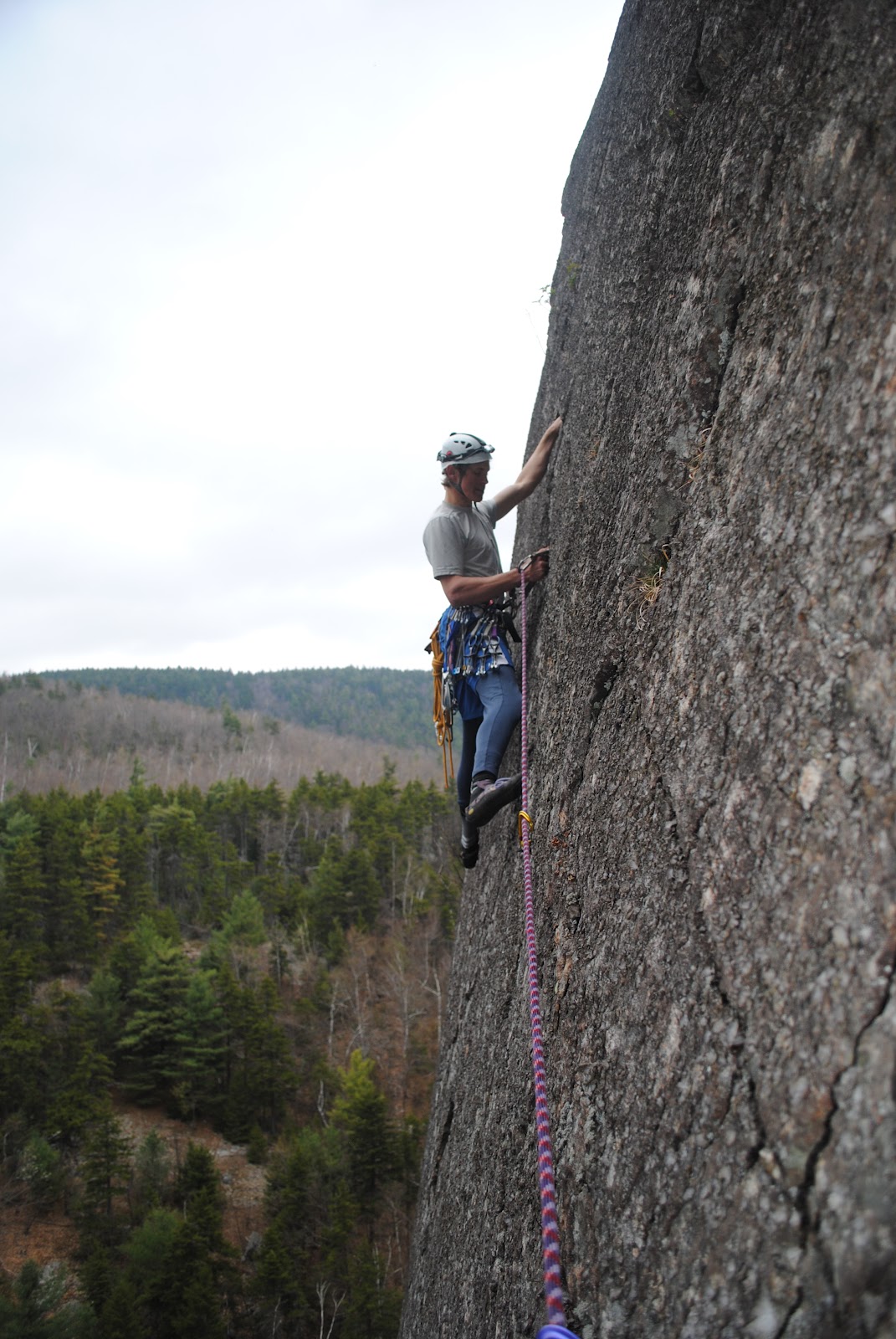
The first route of the day was Final Frontier (5.8+ G 280'). The Adirondack Rock guidebook gave this route a 3 star rating. Cam led the first two pitches, and I took the third.
Instead of stepping right around the overhang on P2, we went directly under it and then up the arete. This led to the face climbing, which was much longer than it looked from below.
 |
| View from the P2 belay |
 |
| Approaching the roof on P2 |
 |
| Slapping rock under the roof to test which blocks are loose. There was a pretty big selection of rock that had to be avoided so I didn't end up crushed at the belay. |
 |
| Cam at the P3 belay |
 |
| All geared up for P3 |
After belaying Cam up P3, I lowered him to the ledge below that had an enormous tree stump and then rapped down off the tree I was anchored to. The tree stump had a couple of old slings around it with two rap rings, but we added a new sling to it instead of trusting the old gear. We also clipped a quickdraw to the new sling and the rope for safety if the rap rings were bad. Hauling the static rope this entire time was well worth it when it came time for this rappel. It was used as a tag line when we did a single line rappel on the dynamic rope. The 70m dynamic rope barely reached the ground, so this was a pretty long drop.
 |
| Full shot of the rappel |
 |
| Coming down the line |
 |
| Free hanging for the last 30 meters |
 |
| Scrambling across the boulder field to the next route |
The next route was The Excellent Adventure (5.9- G 200'). The guidebook shows that this is a 3 pitch climb, but we tied it together in 2.
 |
| Route Description |
 |
| Right leaning crack |
 |
| Cam starting up the crack, a little wet at first. |
There was a fixed belay anchor up where Cam is the the shot above, but he opted to build a new one instead. The old one consisted of an original Hexcentric and 2 micronuts, each with their own carabiner and toed to a master point with an old cordlette. This made me believe that someone a long while ago had abandoned their gear, but not really sure. There were a few other spots around the cliff where similar gear was left behind. Cam belayed me up off of a red tricam backed up by two nuts. Up here we switched belays to continue the climb.
P2/3 started off with a step down past the fixed gear and then a dirty traverse left to the prow. From here it was easy climbing up to the belay/rappel station. We were able to make it down to the ground with one rappel on the 70m rope.

Back on solid ground, we packed up our bags and hiked to the Sunset Arete Area, further left along the cliff. The route that we first went to was Sunset Arete (5.7 PG 150'). The second pitch was supposed to be dirty, so not really worth the climb. Instead, we only did the first pitch (70'). I decided to give it a try on lead, but backed down part way up the arete when it appeared that there was no protection for a while, and I didn't really feel like hitting the deck if I fell. Cam ended up finding some interesting nut placements and built an anchor off of a tree. We lowered on the other side of the arete to end the day with some carefree top roping. The first route that Cam TR'd was Son of Cirrhosis (5.8+ G 60'). To the right of this route was a nice looking face with tiny positive edges and some smooth bulges that we messed around on for a little while.


 |
|

The rain ended upholding off until we started to pack up our bags at the Sunset Arete Area. There were periods of heavy rain on the hike back to the tent, but overall we got very lucky. We made a couple more bags of Ramen when we got back and then packed up the tent in the rain. The rain stopped on the hike back to my car, which took an hour, and then started again when we were on the road. Overall, this was another great trip. No injuries, abandoned gear, and plenty of food and water.


Thanks for the posts dear.
ReplyDeleteGreat report This is in my backyard but I had no idea.... Any idea who was in there before?
ReplyDeleteI recommend Adirondack Rock by Jim Lawyer and Jeremy Haas for information on first ascents and whatnot.
DeleteGreat report. Did you follow the Spuytenduevel (sp?) all the way up? Right or left side? I think finding these cliffs is a challenge in itself!
ReplyDeleteSorry for the late reply, but we actually took the route from the nearest point on the road. We went due north until we were even with the cliff and then followed the small, open ridge up to the base of the climbs.
Delete