Mt. Jefferson is always underestimated. The mountain is very well guarded by dense forests and poor trail networks, the slopes are steep and it is capped by a 300 foot summit pinnacle that is either rimed or choss. This weekend marked my fourth attempt on the peak. The first attempt the winds were high and one of our party suffered a very cold, wet night. We turned around at 8300'. The second attempt, also an overnight on skis looked promising, but we woke up to massive wet slab avalanches on the slopes above the tent. The third attempt was on foot, so my partner and I made good progress up the ridge in ideal spring conditions. Arriving at the knife edge ridge at six in the morning after walking and climbing all night, I led the first pitch across the narrow section and up the rime chute, but the runout was too great for my partner, so I had to down climb this section, the hardest pitch of the route.
 |
| The knife edge ridge (KER) conditions on attempt three |
So, with much anticipation I drove up to the snow line on the road to Woodpecker Ridge TH. Snow left us about a mile short of the actual TH. My partner this time was a very accomplished climber who had done the North Face gully of Hood many times over, Ptarmigan Ridge on Rainer, among others. Anastasia is also very determined, so I was very excited to do this route with her. Her light and fast style was well suited to a climb of this nature. We divided gear at the end of the road: 5 short screws, three pickets, a set of nuts, a few pins, numerous slings, and a very thin Mammut Phoenix 8.0 single.
 |
| Getting ready for the climb at the end of the drivable road. |
Settling down for the night before dark is always hard, especially before a big climb, but even three hours of sleep makes a big difference. We woke at 11:30 and were on the trail before midnight. We walked up the road to the TH in 15 minutes and started the annoyingly difficult partially snow covered trail. The continual post holing, up and downs, and difficult navigation eventually gave way to a snow free trail on the forested ridge. An hour and a half after setting out we reached the junction with the Pacific Crest Trail and started the bushwhack. Fortunately because of recent snowfall, we only spent 1 hour hopping logs and ducking branches until the snow became deep enough to cover everything.
 |
| Finally on the snow covered ridge at 2:30 AM. |
We made steady, but slow progress up through the open bowl onto a bench at 4AM. Post holing here involved stepping through the crust, weighting one's foot, and dropping another four inches. Here the wind started to pick up a little.
 |
| The view looking west as the sun just begins to light the sky. 4:30AM. |
 |
| Nearing the ridge crest. Photo-A. Blagoveshchenskaya |
 |
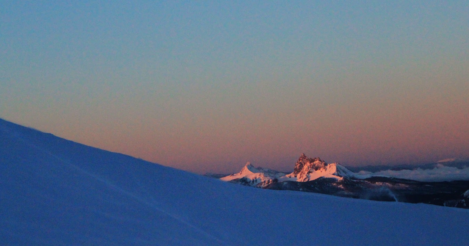
| Three Fingered Jack in the foreground, with Mt. Washington behind. Actual distance to these peaks is 20-40 miles. |
 |
| Three Fingered Jack, Mt. Washington, North Sister, Middle Sister, South Sister, and Broken Top. Later in the day, we could see from Mt. Rainer to Mt. McLoughlin, a straight line distance of over 300 miles! |
 |
| Wind launching spin drift off the ridge crest. |
 |
| Mt. Hood to the north. |
The further we climbed, the more the wind picked up. It never blew much above 25MPH, but still it was difficult of Anastasia being so much lighter than me. We decided to short rope going up the 45 degree slope because the wind made her feel off balance. We crested the ridge just as the sun appeared over the edge of the mountain.
 |
| Winds whipping snow off of Smith Peak, a sub peak on the ridge. |
Between post holing, a long approach, winds, and poor snow it took some time to climb the few hundred feet up the ridge to the base of Smith Peak.
 |
| The slope on Smith Peak, Jefferson Park Saddle, the Mohler Tooth, and the KER. |
 |
| Looking down the 45-50 degree ridge. The prominent rock feature lower down is known as the Prehistoric Monster. |
The snow and winds improved steadily as the sun rose and we climbed higher. On the final traverse Anastasia's plastic boot became untied and it took more time to reach the saddle. There we rested briefly, I racked up, and we set out.
 |
| The spectacular Mohler Tooth and the North Ridge frame the upper part of the Jefferson Park Glacier. The total height of the Mohler Tooth at its highest point is close to 600 feet. |
 |
| Leading out. Photo-A. Blagoveshchenskaya |
The route goes to the rime step, down and right, then up a chute. The first time I climbed this there was solid ice, not so this time. The rime was more like packed powder with some ice well buried under worthless rime. I had to club the tools into the awful stuff until they stuck enough to keep my balance, then reach down, press on the wall and walk my feet up. Very much like climbing a friction chimney, only on ice with 600 feet of exposure. Desperate climbing. Pro for the chute was two worthless 10cm screws with a screamer on one. One inch in they blew through into air.
 |
| At the first belay. Photo-A. Blagoveshchenskaya |
 |
| Looking down the nearly vertical rime chimney and 600' of exposure. Photo-A. Blagoveshchenskaya |
I led the remaining pitch which included some equally desperate down climbing. Due to recent snowfall, all the rocks were covered with four inches of unconsolidated powder. Down climbing involved involved dragging my tools through the snow until I found some purchase, hanging, and searching for purchase for my feet. Scary! When Anastasia followed, I lowered her off a horn and then she climbed up to me where we set up the rappel.
 |
| The view from our high point along the summit ridge to the summit pinnacle (300' high). |
Anastasia expressed some concerns about the rappel sticking, but I was eager to get out before it got any warmer so I convinced her to go. I should have listened because she was absolutely right.
 |
| Rapping off the first time. It's about 40 feet to the snow ramp. Photo-A. Blagoveshchenskaya |
Not wanting to wait around to climb up the rope, I dropped my pack and soloed a short, but slightly overhanging rime step and the climbed back along the ridge. Total time was around two minutes versus a half an hour. I added a sling to the system so the rope hung free and rapped once again.
 |
| The top of the solo and the stuck rope. Photo-A. Blagoveshchenskaya |
 |
| Unfortunately, we decided to leave my cordelette there so that we could rappel down the 50 degree chute. Photo-A. Blagoveshchenskaya |
Following the rappel, I lowered Anastasia on a hip belay, then down climbed to her location. I led through, placing a pin and an orange link cam in classic volcanic rock.
 |
| The down climbing route followed the chute down from the saddle between the Mohler tooth and the Ridge. Anastasia can be seen sitting in a protected cove in the second shadow. Ever a challenge, the exit (behind the camera) was similar to the down climb on the ridge. |
 |
| Classic cascades pin. |
 |
| Back at the car right at nightfall. Now a 2.5 hour drive. |
Once back at the saddle we rested and melted water, recuperating for the descent. I was particularly worried about the rapidly warming temps and so we left as soon as we were fed and watered. Anastasia's crampons were balling and down climbing the steep side hill was challenging. It took several hours to reach safety on the other side of the prehistoric monster. We then got away with glisading the open bowl in very slushy conditions. It was now very late (6PM) and we needed to get back to the trail before dark. I re-broke the trail back down the ridge sinking at least up to the top of my boots every step, but we made it out to the trail by 8PM. Another hour out the trail and we were back at the car, 22 hours after setting out. I drove back and was back at the house by 1:30, 35 hours after leaving.
Having to turn around so close (.2 miles, 400') from the summit only adds to the desire to climb to mountain. My father always reminds me that he climbed it solo on his first try (via Mill Creek North Gully), but then again he almost died from rock fall. Jefferson is certainly a challenging mountain and it deserves more attention than it receives.