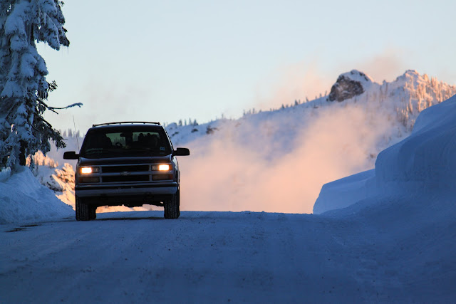
Shortly after Christmas the family drove to Scott Valley in Northern California to visit relatives and to ski. We left at 5 A.M., driving the familiar stretch of I-5 through the Willamette Valley in the dark. After a quick breakfast in Ashland, OR, we started the 3000' climb over Siskiyou Summit. The road was so slippery that very little breaking was possible without chains and so the driving was slow.
 |
| Siskiyou Summit on I-5. CA/OR border. |
Passing through the small ex-mining town of Yreka (the name means
White Mountain) in an ice fog, we turned west, climbing up California 3, over the Anderson Grade, the site of a locally famous stagecoach robbery.
 |
| Anderson Grade on California State Route 3. |
Soon after descending into Scott Valley we came to the sleepy western town of Fort Jones. The snow was still falling and we eagerly anticipated the skiing to come.
 |
| Main St, Fort Jones, CA. |
That night we skinned up a cell tower access road to a small building on top of the hill. The snow deepened and lightened as we approached the crest.
 |
| The distant lights of Fort Jones partially illuminate the night sky as we skin to the top of the hill. |
The next morning we enjoyed a short, but pleasant ski to the car. Soon thereafter, we headed for Etna Pass (5,990').
 |
| The cold waters of the Scott River cut through Scott Valley, CA. |
 |
| Christopher Coppock contemplating the view west from Etna Pass, CA. |
Chains we required, but we elected to leave them off, a gamble that paid off. We reached the pass at the very late hour of noon. We changed and packed quickly. Heading north up the PCST, we found a old skin track to guide us through the woods. A quick 30 minute skin brought us to the first peak, about 400 feet higher than the pass.
 |
| The route we skinned is solid and the lines we skied are dashed. Etna pass is located at the picture icon. |
 |
| Lichen in stark contrast to the bright white of the snow. |
We reached the top and then kept moving out the ridge, aiming for an open area with feet of fresh snow. After deskinning, tightening the straps and testing the beacons, I headed off. At first I was a little hesitant, not wanting to impact the slope too much, but soon I felt more comfortable, arcing turns and popping off little rolls. My brother and father skied next, laying down beautiful tracks as they went. The powder was at least knee high.We ended in a creek drainage with massive, deadly creek holes. Unfortunately there were no photos. We skinned steeply out of the drainage to a partially open ridge, the kick-turns too many to count.
 |
| Skinning up the ridge. |
 |
| The view upwards. |
 |
| Hoar crystals formed everywhere. |
 |
| Nearing the top for the second time. |
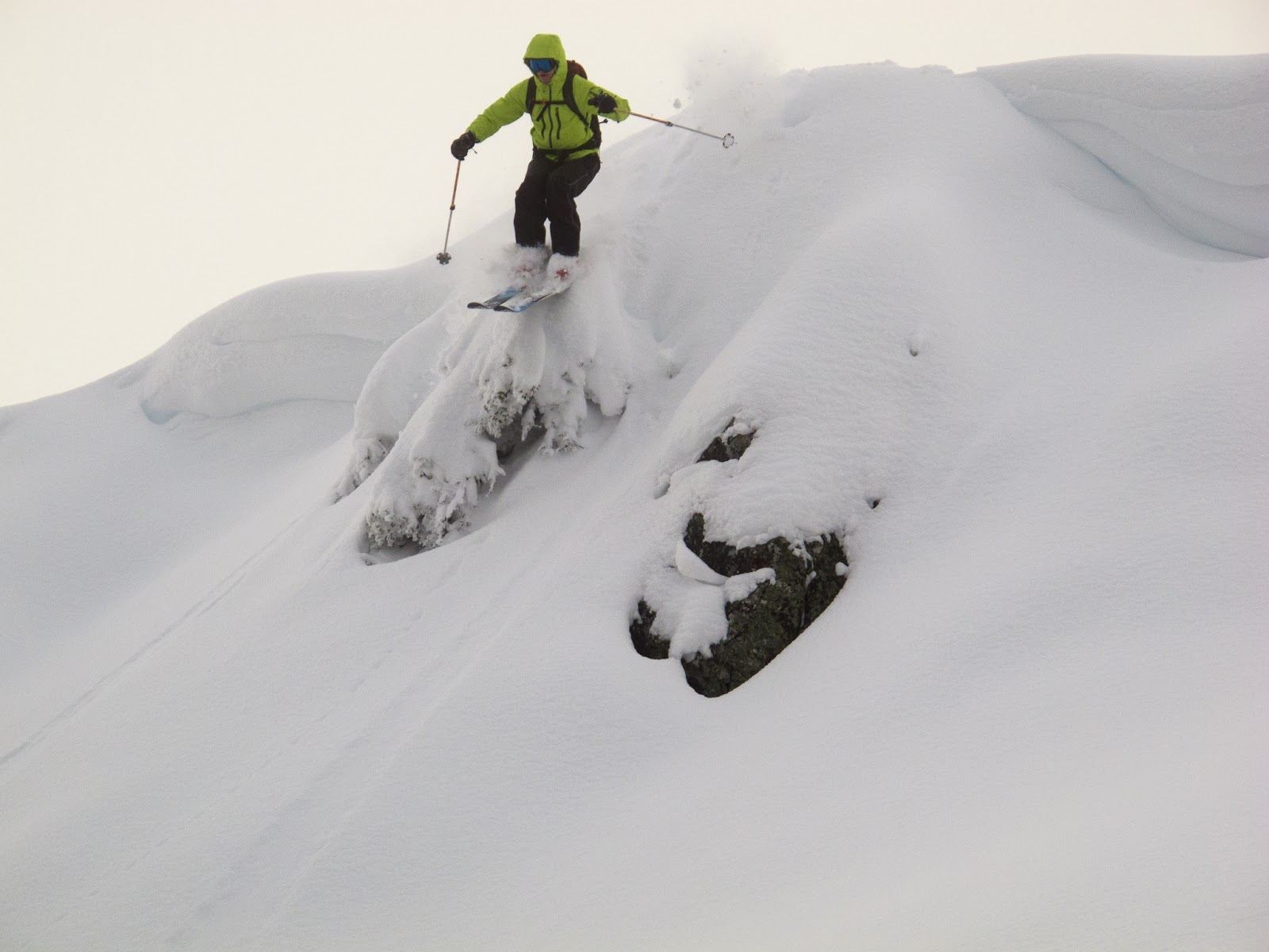
We quickly deskinned and packed up once more, this time aiming for some small (8-10') cliff bands.
 |
| Standing in the snow. 'Nuff said. |
 |
| Looking down at the drops with Etna Pass and the car in the distance. |
 |
| Chris slaying the pow. |
 |
| Tree Skiing. |
After skiing the trees, we soon found ourselves back at the road. My brother is recovering from mono, so he decided to stay at the car and my father and I went up for a sunset run.
Reaching the top, we took our time. The hollow golden glow of a winter sun illuminated the ridges. Dropping off the east side once again into cold, light powder, the alpenglow framed the ridge-top trees.
 |
| Some drops go well... |
 |
| And some do not. This is the "my face is way too cold" expression. |
 |
| Sunset from Etna Pass. |
 |
| The "Sherman Tank" ('98 Suburban) descending from the pass. |
After staying in Yreka for the night, we made our way over the Cascades on our way to Bachelor.
 |
| Mt. Shasta (14,179') rises from the valley. Hwy 97, CA. |
Highway 97 climbs and the road became covered with compacted, washboard ice. Everyone was driving slowly so we spent most of the time in the fast lane. South of Chemult, we saw this:
 |
| Across the oncoming lane and over the guardrail with a pickup and trailer. Totaled. |
We were surprisingly tired after skiing two days previously. The runs at bachelor were rough. Poorly sliced powder moguls. We did make first tracks (for the day) down the chutes.
 |
| The 5 minute walk from the top of the lift brings us to the summit of Mt. Bachelor (9,068') |
Although Bachelor is certainly not my favorite resort due to the lack of steep runs, the views are impressive.
 |
| In order of nearest to furthest. On the left: South Sister, Middle Sister, North Sister. Middle: Three Fingered Jack. Right: Broken Top, Mt. Jefferson, Mt. Hood. |
Etna pass was much better than Bachelor, even though hiking was involved. It is definitely worth checking out if you are in the area. Summer hikes along that section of The Trail are also nice.


No comments:
Post a Comment