Heading south on I-87, The Northway, we drove by Poke-O and Chapel Pond. There were climbers all over Poke-O and a few around Chapel Pond Canyon, but none on Chapel Pond Slabs. We didn't stop the car to get any photos, but here are a couple videos of the conditions. Next time I'll have to hold my phone in landscape mode to make for better viewing, but this'll have to do for now.
Tuesday, February 19, 2013
Monday, February 18, 2013
44.7247° N, 73.9119° W
Where: Clinton County, New York
When: February 16-17
Why: Presidents' Day Weekend
What: Troy to Plattsburgh. Plattsburgh to Chazy Highlands. Skin to the summit of Lyon Mountain and ski down. Take the ferry to VT and head to Burlington. Ferry to Plattsburgh. Back to Lyon Mountain to explore glades seen from the last descent. Drive to Lake Placid to eat and explore. Plattsburgh for the night.
Conditions? See for yourself.
 |
| Skinning up the "Old Trail". |
 |
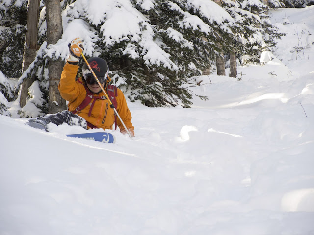
| Knee deep at the summit. |
 |
| Kyle scoping out his line through the trees. |
 |
| First ever cliff drop, albeit small. |
 |
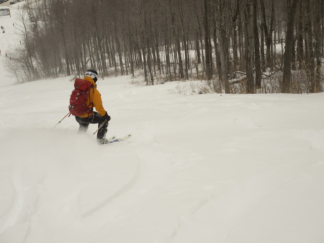
| Face shots! |
 |
| Double dropping the pillows. |
 |
| Stuck in the powder, can't complain. |
Labels:
adirondacks,
backcountry,
chazy lake,
lyon mountain,
powder,
skiing,
skinning,
Snow
Location:
Lyon Mountain, NY, USA
Saturday, February 9, 2013
Finding Nemo
It's four in the morning. It's illegal to drive on the roads in Massachusetts. Good thing we are heading to Vermont. We only pass two vehicles on the road the entire hour and a half drive from Troy to Stratton Mountain, not a huge surprise. Arriving at the mountain, we find that the "members only" parking lot is not guarded and that the door to the lodge is open even though all the lights are off, great success. Headlamp on, boots on, skis on, skins on; off we go.
 |
| Untouched snow all around. |
 |
| Skinning up under the gondola. Luckily following snowmobile tracks part of the way up. |
After about an hour and a half of skinning we were at the summit and ready to ski down. A handful of ski patrol and medic staff skied past us, but there was still plenty of fresh powder to go around. Only having skied once before, and not on powder, it took me a few turns to get the hang of it again. Kyle cruised down with the goal of warming up after our cold stop to take off skins and transition to ski mode.
 |
| Powder 5" to knee deep in spots. |
As the lines grew our patience did not. Back to skinning to scope out a trail that only has a few tracks through it. We make it up as high as possible before the snow was so blown that exposed roots and rocks were in the way. It was a quick run, but some of the best snow of the day. Time to let the quads rest up. Skiing powder isn't easy, not that I'm complaining.
 |
| Rocks up ahead, time to ski down. |
Location:
Stratton, VT, USA
Thursday, February 7, 2013
Dyrehave
The following photos were taken on the DTU campus and in a place known as Dyrehave. Dyrehave is the grounds for the Eremitage Palace, an 18th century hunting lodge with a grand view over the low rolling hills of the land. The large park is fenced so that the deer, which walk about in large herds, can roam freely. The photos were taken with a Canon G12 and a mini-tripod, and some shots are slightly motion blurred.
The hike on which these pictures were taken started as a spontaneous decision at 9PM and ended up being significantly longer than expected. Instead of a 5 mile walk, it became 8 miles. The route map below is only approximate.
 |
| Kampsax Kollegiet and the circular, roofed bike shelters. |
 |
| A snowy walkway in Kampsax Kollegiet. |
 |
| The 5km ring trail around campus. |
 |
| One of DTU's boiler rooms. |
 |
| The view from the entrance to the main building in DTU. |
 |
| The forests surrounding Eremitagesletten. The yellowish light is light pollution from nearby Lyngby. |
 |
| Eremitagesletten |
 |
| Eremitage Palace from afar. |
 |
| Eremitage Palace |
 |
| The lights of Landskrona, Sweden across the North Sea from Strandvejen. |
 | |
| The shoreline of Øresund facing northward. |
Subscribe to:
Posts (Atom)


